New CRAN Package {envi}
My third R package is published in the Comprehensive R Archive Network named envi. It estimates the ecological niche using presence/absence data and the spatial relative risk function via the sparr package. See the public Github repository for more details.

Society for Epidemiologic Research 2020
I presented my abstract entitled “Geographic variation in the oral microbiome of Agricultural Health Study applicators” at the Society for Epidemiologic Reserach 2020 annual meeting held virtually due to the global COVID-19 pandemic.

New CRAN Package {gateR}
My second R package is published in the Comprehensive R Archive Network named gateR. It estimates clustering of cytometry cells using markers and the spatial relative risk function via the sparr package. See the public Github repository for more details.

2021 William G. Coleman Minority Health and Health Disparities Research Innovation Award
I received a William G. Coleman Minority Health and Health Disparities Research Innovation Award from the National Institute on Minority Health and Health Disparities (NIMHD) for a joint research proposal entitled “HDoCS in PLCO: Health Disparities of Cancer Survivors in the Prostate, Lung, Colorectal, and Ovarian Cancer Screening Trial.”

DCEG Fellows Award for Research Excellence
I received a DCEG Fellows Award for Research Excellence from the NCI Division of Cancer Epidemiology and Genetics for an abstract entitled “Geographic variation in the oral microbiome of NIH-AARP Diet and Health Study participants.”

Co-Editor-in-Chief of DFEB
I took over for Dr. Sarah Jackson as Co-Editor-in-Chief of the DCEG Fellows Editorial Board (DFEB). I join Dr. Maeve Bailey-Whyte in this role.

International Society for Environmental Epidemiology 2020
I presented my abstract entitled “Geographic variation in the oral microbiome of NIH-AARP Diet and Health Study Participants” at the 32nd Annual Conference of the International Society for Environmental Epidemiology held virtually due to the global COVID-19 pandemic.

Creating a hexsticker for the {sparrpowR} package
I present code to create the hexsticker for the sparrpowR package using the hexSticker and spatstat packages. The sparrpowR calculated the statistical power for a spatial relative risk function from the sparr package.

New CRAN Package {sparrpowR}
My first R package is in the Comprehensive R Archive Network named sparrpowR. It provides a statistical power calculation for the spatial relative risk function via the sparr package. See the public Github repository for more details. The featured image comes from the package vignette.
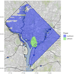
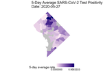
Animating Spatio-Temporal COVID-19 Data
I present an update to my previous posts #1 and #2. This update can also be found on a public GitHub repository.